.svg)

Ordnance Survey Partnership
02
Apr
,
2026


We’ve partnered with Ordnance Survey to offer route planning with OS Maps. Giving Pilgrims now have a 60 Day extended free trial of OS Maps Premium.
Giving Pilgrims can find the discount code when logged in to their profile. Not a Giving Pilgrim? Sign up for this and many more offers. Giving Pilgrims help to support our wider charitable work and the free resources we offer to all pilgrims.
See Ordnance Survey's top 21 modern pilgrimage routes you can plan in OS Maps
Trusted mapping for Britain’s pilgrimage routes
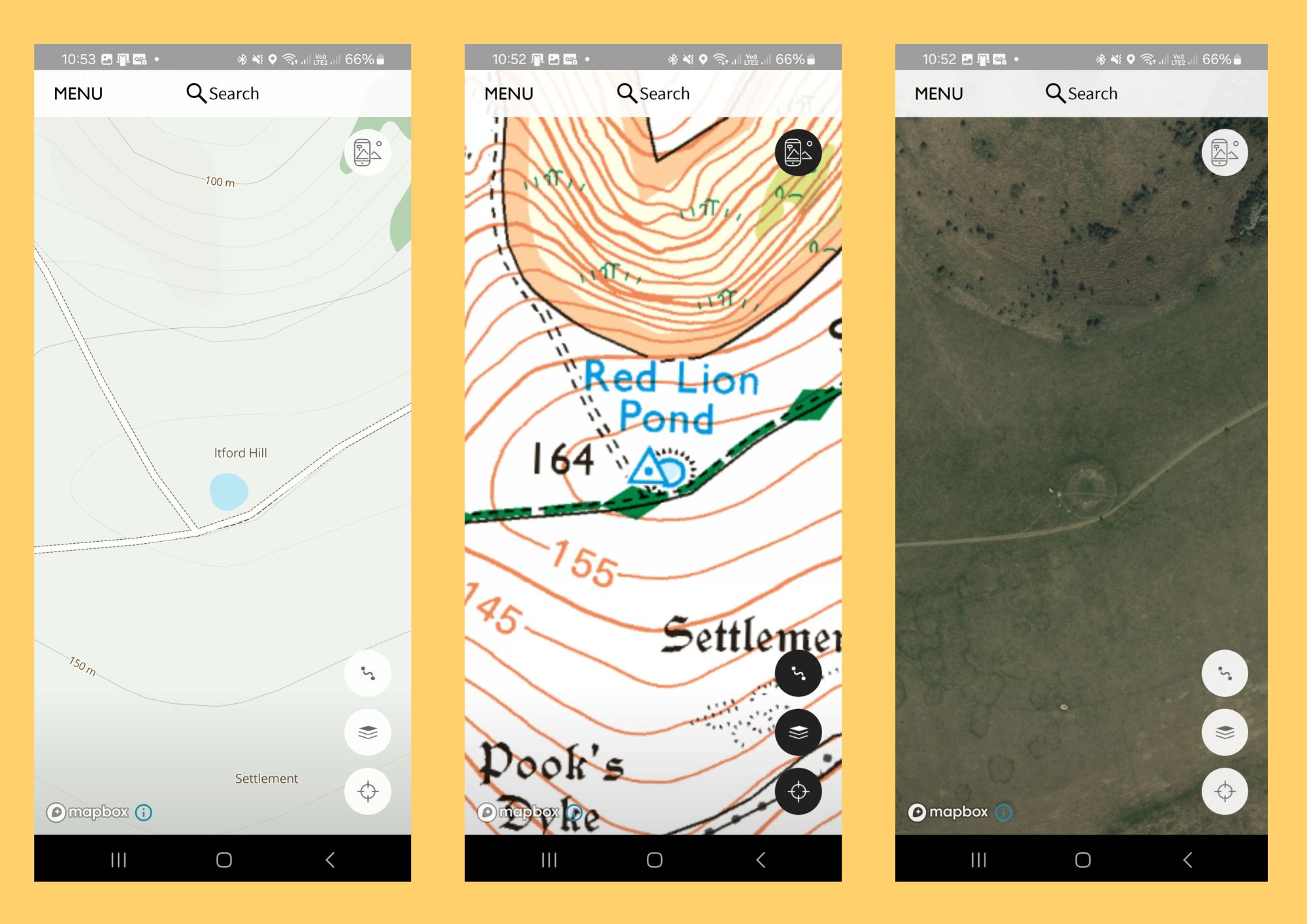
Walk with confidence using every OS Explorer (1:25k) and OS Landranger (1:50k) map for Great Britain. That’s 607 detailed maps, covering ancient paths, modern rights of way, villages, churches, and countryside, available online, printed, or on your phone.
Reliable navigation on long-distance walks
Download maps and routes to your phone so you can navigate without mobile signal, ideal for rural stretches, coastal paths, and remote sections of pilgrimage routes.
Always know where you are
Use Locate Me, built into OS Maps, to pinpoint your exact location using a digital compass and OS grid references. A reassuring tool when following historic routes or navigating unfamiliar landscapes.
Plan each stage of your journey with clarity
Use the OS Maps Aerial 3D layer and 3D Flythrough on both desktop and mobile to explore routes in advance. Visualise terrain, gradients, valleys, and climbs so you can plan daily stages, understand the physical demands of each section, and walk at a pace that suits your pilgrimage.
Seamless planning across devices
Your OS Maps account automatically syncs across desktop and mobile. Plan routes on the web at home, then follow them on your phone while walking, with maps and routes always up to date wherever you are.
Trusted by those who rely on accurate navigation
OS Maps is the only navigation app officially recommended by Mountain Rescue, and is used by all 47 volunteer Mountain Rescue teams in England and Wales, a mark of trust, accuracy, and reliability in the outdoors.
OS Maps Premium Annual Subscription: 60 day free trial. Then £35.99/year ongoing subscription unless cancelled. New subscribers only. Not valid with other offers. 1 trial per person. Offer expires 31/03/2027. Full T&Cs apply.

.svg)


Further reading


.svg)
Comments
0 Comments
Login or register to join the conversation.
Tom Jones
Lorem ipsum dolor sit amet, consectetur adipiscing elit. Suspendisse varius enim in eros elementum tristique. Duis cursus, mi quis viverra ornare, eros dolor interdum nulla, ut commodo diam libero vitae erat. Aenean faucibus nibh et justo cursus id rutrum lorem imperdiet. Nunc ut sem vitae risus tristique posuere.